Great Woolden Iron Age Roundhouse Site

Great Woolden Iron Age Roundhouse Site

Great Woolden top

Just north of Great Woolden Hall Farm, on a sandy ridge overlooking the Glazebrook, lies a roundhouse site which was occupied from the late Iron Age into the Romano-British period. Greater Manchester Wetlands Trainee, Lorna investigates...

The Iron Age Roundhouse site was first spotted by a crop mark that lasted less than a day and excavated between 1986 and 1988.

Lying on the edge of Great Woolden Moss which, like Little Woolden Moss, was one of many bogs or mosses[1] which formed the ten mile expanse of the great ridge-raised mire known as Chat Moss it has much to teach us about how prehistoric people related to the mosslands.[2]

Its location on a sandy ridge is significant. The earliest hunter-gatherers of the Mesolithic period left scattered flints on a ‘small sandy knoll’ at Nook Farm, Eccles, and burnt stone and a single flint on a ‘low sandy patch of skirtland’ at Moss Side, Astley Moss.[3] When the landscape was dominated by birch and pine and the peat bogs were slowly beginning to form in wet hollows and wet basins the people favoured drier sandier ridges to camp and make tools.

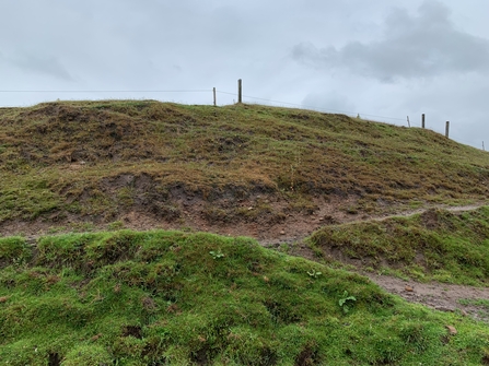
Great Woolden Sandy Bank

Great Woolden Sandy Bank

In the Neolithic and early Bronze Age further development of peat bogs is shown in the palaeoecological records by vegetation dominated by cottongrasses and bands of Sphagnum cuspidatum. From this time there is evidence for land-clearance and small-scale agriculture at Nook Farm.

From this period, at Great Woolden a selection of lithics – waste flakes, scrapers and cores, was found. This provides evidence for the production of tools. To professor Michael Nevell, who carried out the excavations, this suggests ‘ephemeral occupation… a temporary camp’ yet ‘there is a strong possibility that a much larger site has been eroded by the Glazebrook.’[4]

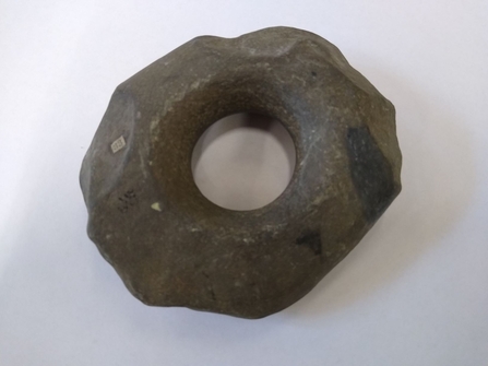
A perforated stone hammer made of local grit was deposited in the river Irwell near Irlam. Depositions of stonework and metalwork in rivers and wetlands were common at this time and suggest that wet places were seen as sacred and associated with the gods and spirits. The location is less than a two mile journey by foot or canoe down the Glazebrook from the Great Woolden camp or settlement and it seems likely this offering was made by the people who were making their tools. Nevell notes the signs of ‘percussion’ indicate the use of ‘a hammer stone.’

Perforated hammerstone

Perforated hammerstone

In the late Bronze Age and Early Iron Age the weather grew cooler and wetter and the peat bogs expanded. Sphagnum imbricatum is shown to dominate in the palaeoecological records. Across Britain this period has been associated with a peak in metalwork deposition in bogs and other wet places, perhaps to appease the gods, and with the movement of people to hill-forts.

In the late Iron Age a promontory enclosure with double ditches and four circular structures or roundhouses (two 13 – 15m and the others 8m and 5m in diameter) was built on the sandy ridge at Great Woolden. It was occupied from 120 BC into the Romano-British period until 320 AD.

The inner ditch varied from 3m to 4.5m in width and its depth from 1m to 1.3m. The outer ditch was 3m to 4m wide and 1.3 to 1.8m deep. The distance between them was 5m to 7m. Due to the shallowness of the ditches and the absence of a palisade Nevell says they were not defensive, but boundary markers, drainage channels, or used for ‘the corralling of livestock’.[5]

From the ditches and the stakeholes a significant amount of prehistoric pottery was recovered. This included a hand-made bowl manufactured on-site from local clay, a jar of dark-brown fabric with quartz inclusions typical of the local Brigantian pottery industry[6], and a red-brown cooking pot of Gallo-Belgic type which may have come from South-East England.

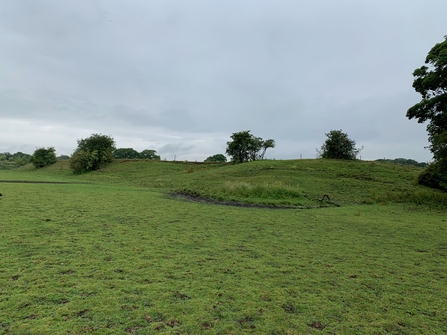
Great Woolden Promontory

Great Woolden Promontory

Additionally, over 1kg of Cheshire Very Coarse Pottery sherds were found from ‘orange cylindrical vessels with a flared rim, in low-fired clay containing large quartz inclusions’ linked by Nevell with the ‘late prehistoric pottery industry in Cheshire’.[7] Such vessels may have originated in the Nantwich-Middlewich area and been used to transport salt. A large amount of Roman coarse ware pottery was also discovered on site. These finds suggest the existence of an extensive trading network between the Iron Age tribes of Britain and beyond.

Two fragments of querns were also found. The first was a ‘grit stone grain rubber from a saddle quern’[8] which would have been moved back-and-forth across a stationary lower stone to grind grain. The second was the ‘lower stone of a grit stone rotary quern’.[9] This would have had a central hole called an ‘eye’ and a slot for a handle by which the quern was rotated.

Bread and cakes made from the flour ground by the querns were probably baked in the two ovens in which the bones of sheep and pig were found (these were also buried in pits on site). There were also four hearths, two in the larger roundhouses, which might have been used for cooking (one can picture the cauldron over the roaring flames) and/or for making pottery or tools.

The evidence presents us with the picture on an Iron Age farmstead whose occupants practiced small-scale agriculture and kept sheep, pigs, and perhaps cattle. It appears they largely lived self-sufficiently, growing their own grain, raising and slaughtering their own animals. They even manufactured their own pottery and perhaps tools. Nevell suggests they produced a surplus which was exchanged for Cheshire Very Coarse Pottery and Roman coarse pottery.[10] 

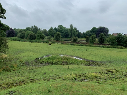
Great Woolden view from Promontory

Great Woolden view from Promontory

Another Iron Age ditch a mile to the north on the edge of Little Woolden Moss was likely dug by the same people, again as a boundary marker, for drainage, or corralling livestock. This suggests their lands were extensive and the whole of the settlement may not have been found.

Unfortunately, we do not know where the occupants of the Great Woolden site buried their dead. As the land has been badly damaged by ploughing it is possible their burial mound was destroyed. Another alternative is that they used the barrows close to Winwick seven miles away.

This site offers a fascinating snapshot of the everyday lives of the prehistoric farmers who inhabited the edge of Chat Moss. It shares parallels with other Iron Age enclosures in the Mersey Basin such as Brookhouse, Irby, and Mellor, where Cheshire Very Coarse Pottery was also found.

It shows how the people not only survived but prospered on a small strip of land beside the expanding mossland, which they must have viewed with a mixture of fear and reverence, held at bay with drainage ditches and perhaps with offerings of pottery in them to the gods of the bog.

Go there now and there is nothing to be seen of the roundhouses or the ditch but, if you stand on the promontory, look out across the Glazebrook, and the fields where Great Woolden Moss lay before its drainage you may catch a glimpse of what our ancestors saw.

Acknowledgements

With thanks to Hannah White at Warrington Museum and Archives for allowing me to visit photograph the perforated hammerstone and for permission to use the photograph.

Thank you to Philip Jeffs at Warrington Museum and Archives for giving me access to valuable documents and for allowing me to visit the Great Woolden Hall Farm Iron Age roundhouse site which lies on his family’s land and for permission to use the photographs.

Finally thank you to Michael Nevell at Salford University for sending me additional documents about the context of the Great Woolden Hall Farm Iron Age roundhouse site and letting me know that the finds are located in the Salford Museum.

References

[1] ‘Moss’ or ‘mossland’ is a northern English word for a peat bog and here is used interchangeably.

[2] The name ‘Chat Moss’ was first written down in 1277 as Catemoss, in old English, and ‘may derive from a personal name Ceatta, or from ceat, meaning a wet piece of ground’. Great and Little Woolden were recorded as Vulueudene, a Norse word meaning ‘Wolf Valley’, in 1299. D. Hall et al, The Wetlands of Greater Manchester, (Lancaster Imprints, 1995), p20 – p 22

[3] Ibid. p26 -27

[4] Michael Nevell, 'Great Woolden Hall Farm: A model for the Material Culture of Iron Age and Romano-British Rural Settlement in North-West England?', Archaeology North West, Vol. 3, Issue 13, (1998), p59

[5] Michael Nevell, 'Great Woolden Hall Farm: A model for the Material Culture of Iron Age and Romano-British Rural Settlement in North-West England?', Archaeology North West, Vol. 3, Issue 13, (1998), p59

[6] The Brigantes ‘the High Ones’ were an Iron Age tribe associated with the Pennines.

[7] Michael Nevell, ‘Great Woolden Hall Farm: A Model for the Material Culture of Iron Age and Romano-British Rural Settlement in North-West England?’, Archaeology North West, Vol. 3, Issue 13, (1998), p59

[8] Ibid. p59

[9] Ibid. p59

[10] Ibid. p61

Lorna's traineeship has been funded by The Green Recovery Challenge Fund - a short-term competitive fund to kick-start environmental renewal whilst creating and retaining a range of jobs. Accessed through the Greater Manchester Environment Fund it supports environmental charities and their partners to deliver projects in England. 

Apply for funding Support us